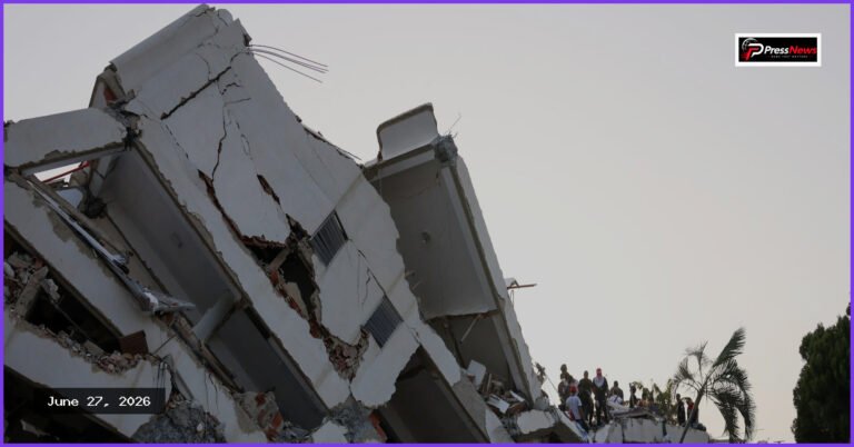
Newly released satellite photography has captured the extensive ruin left behind in Venezuela following two consecutive, powerful earthquakes that struck on Wednesday, claiming the lives of more than 900 people. Occurring just west of the capital city of Caracas, the seismic events measured 7.2 and 7.5 in magnitude, striking within a minute of each other just after 6 p.m. These tremors represent the strongest earthquake activity to impact the nation in more than a century.
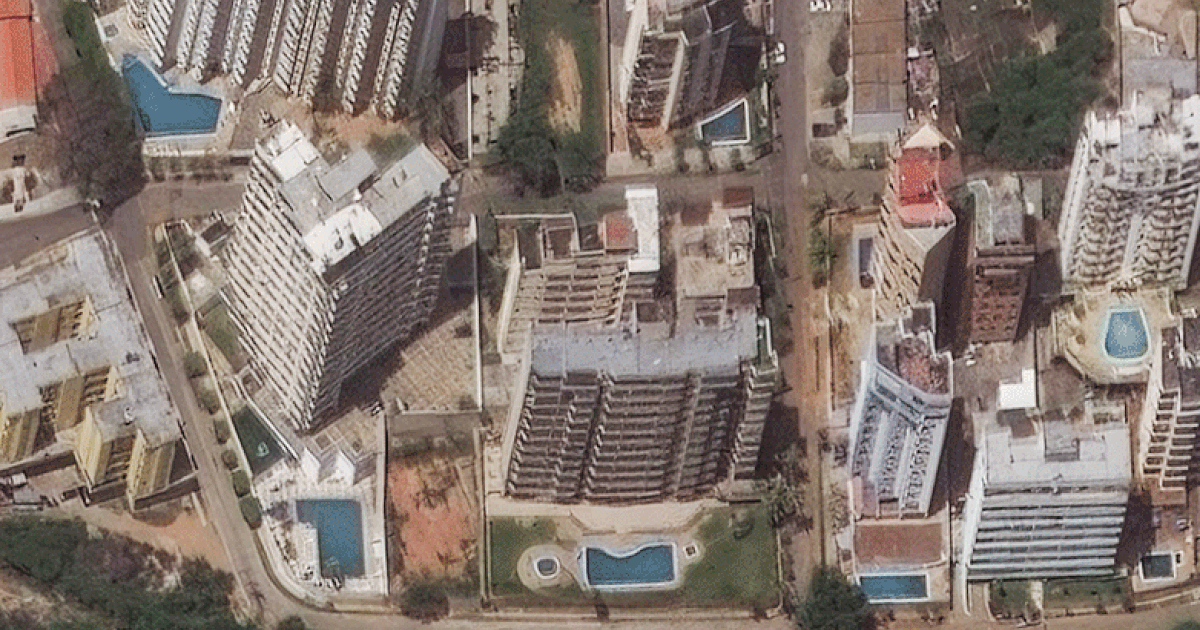
The state of La Guaira, situated along the northern coastline just north of Caracas, experienced particularly severe impacts. Imagery provided by Planet Labs PBC and Vantor reveals the clear evidence of collapsed structures and shattered road networks throughout the coastal urban centers of Catia La Mar, Macuto, and Caraballeda. Amidst the debris, rescue crews are engaged in a critical race against time to locate and save individuals trapped under fallen buildings.
In the aftermath of this disaster, international efforts have intensified, with various nations—including the United States—actively mobilizing search-and-rescue teams and committing humanitarian assistance. The United Nations is currently on-site, managing relief efforts supported by a global fund. The U.S. government has pledged $150 million in aid for Venezuela, and Pope Leo has contributed an initial donation of 100,000 euros to support relief operations.
The occurrence of two earthquakes of similar intensity happening nearly simultaneously in the same geographical region is scientifically referred to as a doublet sequence. These ruptures took place along the boundary shared by the South American and Caribbean tectonic plates.